Skip to product information
1 of 3

Elvet Property Services

3D Scans

Starting from: £750.00 GBP

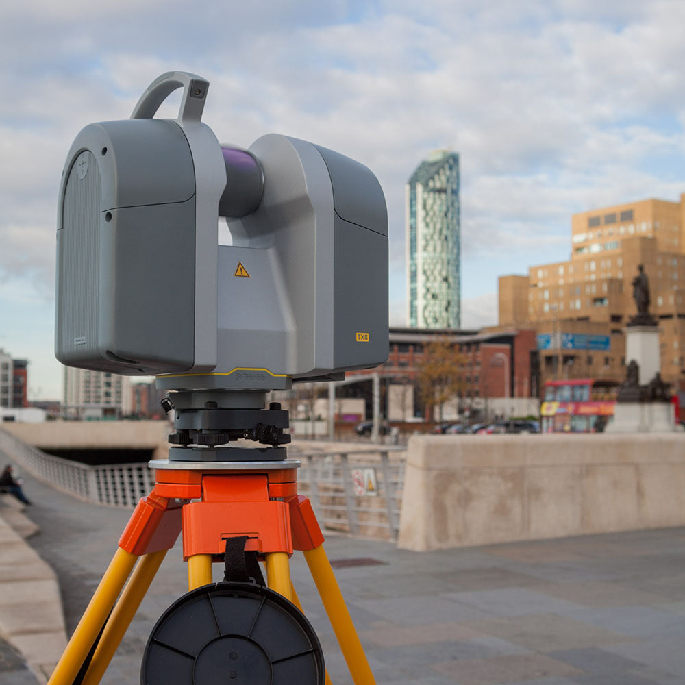
Elvet Chartered Surveyors have invested in a state-of-the-art 3D Digital Scanner, which is capable of measuring over 1-milliion individual points per second; offering fast, high quality data capture with unrivaled levels of accuracy.

The scanner maintains this high degree of precision even at ranges over 340m enabling interrogate design features and fine detail (<1mm spacing) to be captured on both tall buildings and large construction sites alike.

APPLICATIONS:

Architecture

• We are able to quickly produce photo-realistic, high impact visuals and as-built drawings which can be used to analyse and simulate the built environment.
• The point-cloud information is fully compatible with Autodesk® products, and enables the scan data to be easily converted into highly accurate floor plans, elevations, sections and 3D visualisation. The software contains a BIM platform, facilitating the integration of intelligent elements and can be shared with a multi-discipline design team to promote collaborative working.

Heritage

• The scan data is captured using non-invasive measures and can produce a complete and precise 3D digital model of any site of historical or archaeological significance.
• Generating a perfect digital reproduction of a building or artefact will map the intricacies and imperfections of each element and facilitate an assessment of the current condition. This level of detail can be invaluable when undertaking renovation and conservation projects, where an inventory of the original condition is captured at a point in time.
• Once the information is within a virtual environment, specialist architects and designers can manipulate the scan date to reconstruct lost or damaged elements.

Civil Engineering

• The range, accuracy and performance of our 3D digital scanner makes it the first-choice instrument when capturing the real-world properties of any large or difficult to access structure e.g. bridges, towers, excavations, roads, topography and rail etc.
• Scan data can be used for accurate deformation monitoring and alert the client to any change in shape or form within the structure between set time periods. Early notice of movement will enable remedial measures to be prescribed in an efficient and timely manner.
• Similarly, new-build ‘as-built’ structures can be scanned and compared directly against the design information to ensure that works have been completed within any specified tolerances.